| Parent directory/ | - | - |
| abi_rgb_Upper-Level_Tropospheric_Water_Vapor_map.png | 7559039 | 2026-Jun-06 09:20 |
| abi_rgb_Upper-Level_Tropospheric_Water_Vapor.png | 7446080 | 2026-Jun-06 09:19 |
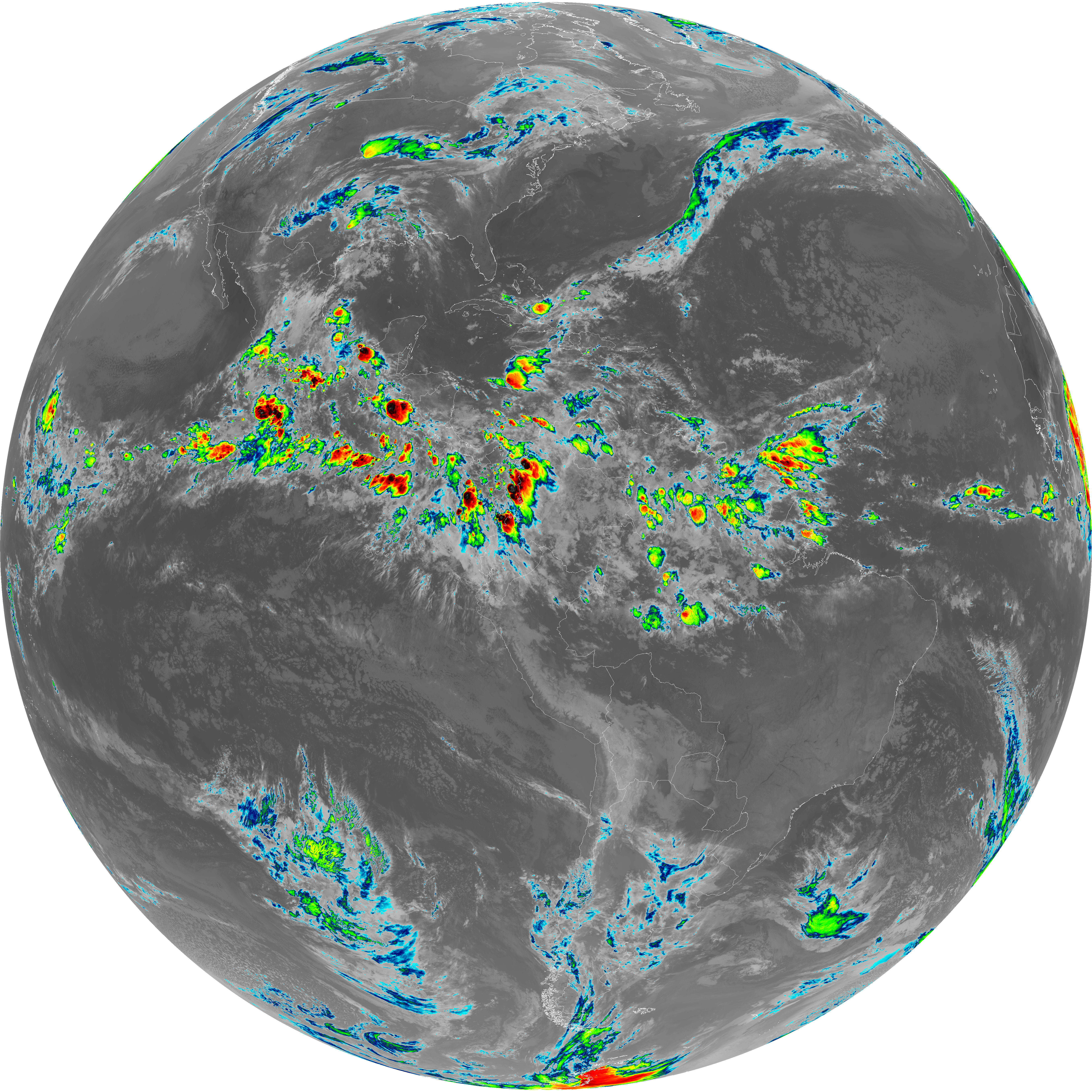
| abi_rgb_Shortwave_Window_Band_map.png | 15413172 | 2026-Jun-06 09:13 |
| abi_rgb_Shortwave_Window_Band.png | 15359372 | 2026-Jun-06 09:13 |
| abi_rgb_Mid-level_Tropospheric_Water_Vapor_map.png | 8753661 | 2026-Jun-06 09:22 |
| abi_rgb_Mid-level_Tropospheric_Water_Vapor.png | 8652972 | 2026-Jun-06 09:22 |
| abi_rgb_Infrared_Longwave_Window_Band_map.png | 14212209 | 2026-Jun-06 09:25 |
| abi_rgb_Infrared_Longwave_Window_Band.png | 14169284 | 2026-Jun-06 09:25 |
| abi_rgb_Dirty_Longwave_Window_map.png | 13899899 | 2026-Jun-06 09:28 |
| abi_rgb_Dirty_Longwave_Window_-_CIRA_map.png | 12181874 | 2026-Jun-06 09:28 |
| abi_rgb_Dirty_Longwave_Window_-_CIRA.png | 12124155 | 2026-Jun-06 09:28 |
| abi_rgb_Dirty_Longwave_Window.png | 13853040 | 2026-Jun-06 09:28 |
| abi_rgb_Clean_Longwave_IR_Window_Band_map.png | 14035759 | 2026-Jun-06 09:16 |
| abi_rgb_Clean_Longwave_IR_Window_Band.png | 13992631 | 2026-Jun-06 09:16 |
| G19_9_20260606T090021Z.png | 6456086 | 2026-Jun-06 09:21 |
| G19_8_20260606T090021Z.png | 5579145 | 2026-Jun-06 09:19 |
| G19_7_20260606T090021Z.png | 11347949 | 2026-Jun-06 09:13 |
| G19_2_20260606T090021Z.png | 3945564 | 2026-Jun-06 09:17 |
| G19_15_20260606T090021Z.png | 10318988 | 2026-Jun-06 09:27 |
| G19_14_20260606T090021Z.png | 10584027 | 2026-Jun-06 09:25 |
| G19_13_20260606T090021Z.png | 10426309 | 2026-Jun-06 09:16 |