| Parent directory/ | - | - |
| abi_rgb_Shortwave_Window_Band_map.png | 14481228 | 2026-Jun-06 12:43 |
| abi_rgb_Shortwave_Window_Band.png | 14421585 | 2026-Jun-06 12:43 |
| abi_rgb_Infrared_Longwave_Window_Band_map.png | 14173862 | 2026-Jun-06 12:57 |
| abi_rgb_Infrared_Longwave_Window_Band.png | 14135469 | 2026-Jun-06 12:57 |
| abi_rgb_Clean_Longwave_IR_Window_Band_map.png | 14007426 | 2026-Jun-06 12:46 |
| abi_rgb_Clean_Longwave_IR_Window_Band.png | 13968464 | 2026-Jun-06 12:46 |
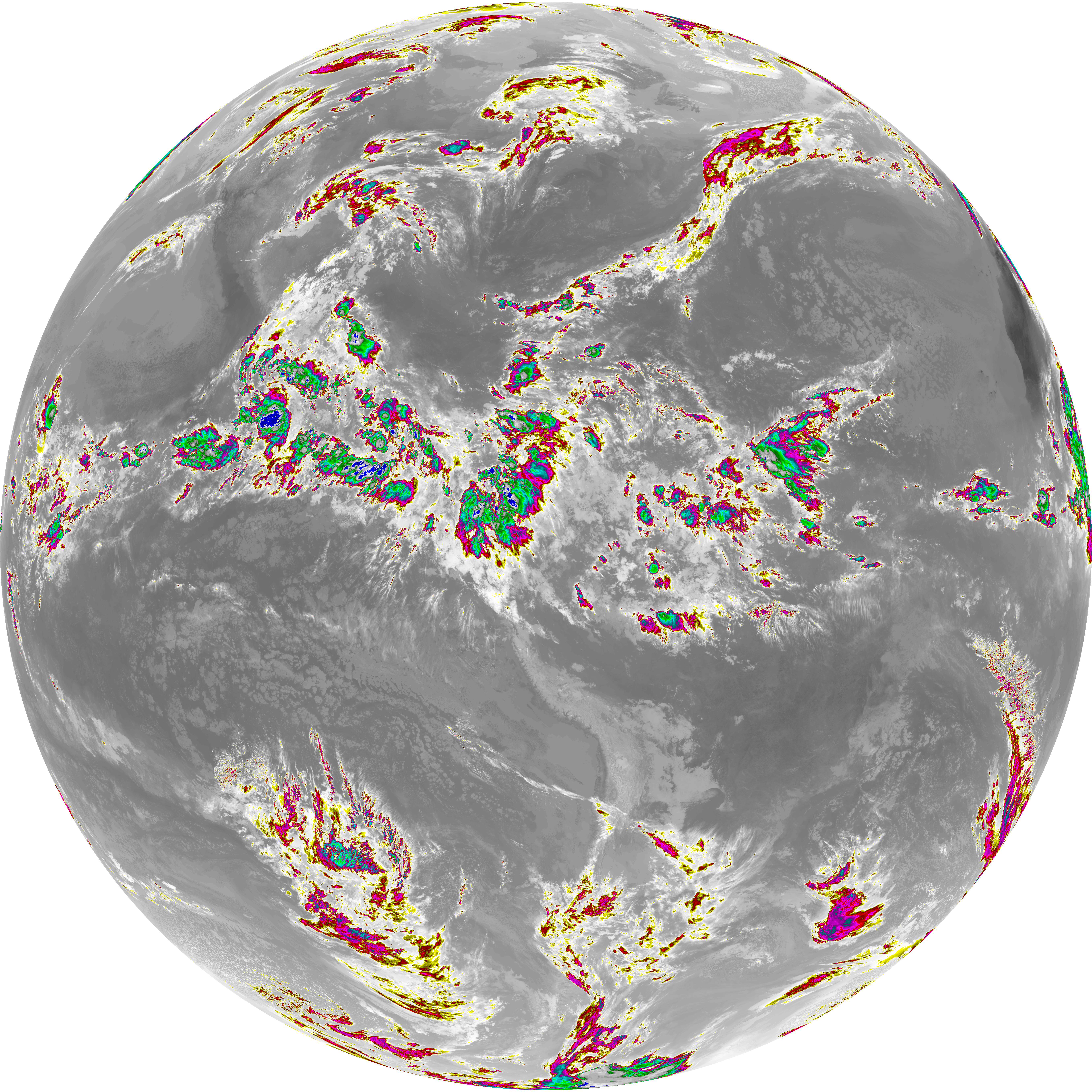
| abi_rgb_Dirty_Longwave_Window_map.png | 13866497 | 2026-Jun-06 13:00 |
| abi_rgb_Dirty_Longwave_Window.png | 13824771 | 2026-Jun-06 12:59 |
| abi_rgb_Dirty_Longwave_Window_-_CIRA_map.png | 12204582 | 2026-Jun-06 13:00 |
| abi_rgb_Dirty_Longwave_Window_-_CIRA.png | 12150703 | 2026-Jun-06 13:00 |
| G19_2_20260606T123021Z.png | 10591963 | 2026-Jun-06 12:49 |
| G19_14_20260606T123021Z.png | 10550782 | 2026-Jun-06 12:56 |
| G19_7_20260606T123021Z.png | 10520566 | 2026-Jun-06 12:43 |
| G19_13_20260606T123021Z.png | 10406374 | 2026-Jun-06 12:46 |
| G19_15_20260606T123021Z.png | 10283305 | 2026-Jun-06 12:59 |
| abi_rgb_Mid-level_Tropospheric_Water_Vapor_map.png | 8857924 | 2026-Jun-06 12:53 |
| abi_rgb_Mid-level_Tropospheric_Water_Vapor.png | 8757066 | 2026-Jun-06 12:53 |
| abi_rgb_Upper-Level_Tropospheric_Water_Vapor_map.png | 7657827 | 2026-Jun-06 12:51 |
| abi_rgb_Upper-Level_Tropospheric_Water_Vapor.png | 7546671 | 2026-Jun-06 12:51 |
| G19_9_20260606T123021Z.png | 6530293 | 2026-Jun-06 12:53 |
| G19_8_20260606T123021Z.png | 5657645 | 2026-Jun-06 12:51 |