| Parent directory/ | - | - |
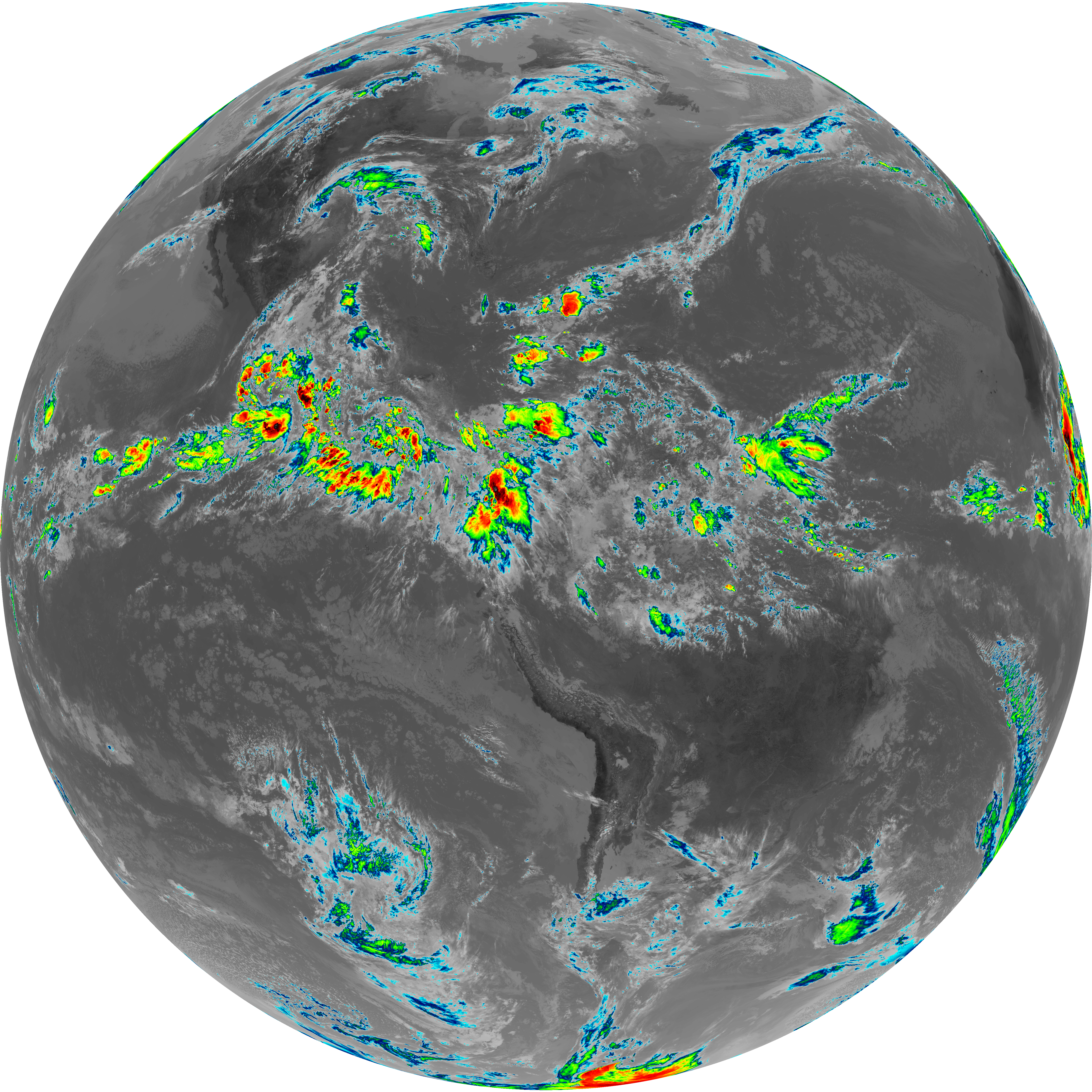
| abi_rgb_Upper-Level_Tropospheric_Water_Vapor_map.png | 7889009 | 2026-Jun-06 16:24 |
| abi_rgb_Upper-Level_Tropospheric_Water_Vapor.png | 7780884 | 2026-Jun-06 16:24 |
| abi_rgb_Shortwave_Window_Band_map.png | 14543951 | 2026-Jun-06 16:13 |
| abi_rgb_Shortwave_Window_Band.png | 14497518 | 2026-Jun-06 16:13 |
| abi_rgb_Mid-level_Tropospheric_Water_Vapor_map.png | 9131125 | 2026-Jun-06 16:26 |
| abi_rgb_Mid-level_Tropospheric_Water_Vapor.png | 9033946 | 2026-Jun-06 16:26 |
| abi_rgb_Infrared_Longwave_Window_Band_map.png | 14751134 | 2026-Jun-06 16:29 |
| abi_rgb_Infrared_Longwave_Window_Band.png | 14729083 | 2026-Jun-06 16:29 |
| abi_rgb_Dirty_Longwave_Window_map.png | 9199304 | 2026-Jun-06 16:58 |
| abi_rgb_Dirty_Longwave_Window_-_CIRA_map.png | 8170378 | 2026-Jun-06 16:58 |
| abi_rgb_Dirty_Longwave_Window_-_CIRA.png | 8102903 | 2026-Jun-06 16:58 |
| abi_rgb_Dirty_Longwave_Window.png | 9138338 | 2026-Jun-06 16:58 |
| abi_rgb_Clean_Longwave_IR_Window_Band_map.png | 14594041 | 2026-Jun-06 16:16 |
| abi_rgb_Clean_Longwave_IR_Window_Band.png | 14571440 | 2026-Jun-06 16:16 |
| G19_9_20260606T160021Z.png | 6728504 | 2026-Jun-06 16:26 |
| G19_8_20260606T160021Z.png | 5837154 | 2026-Jun-06 16:24 |
| G19_7_20260606T160021Z.png | 10589930 | 2026-Jun-06 16:13 |
| G19_2_20260606T160021Z.png | 16300428 | 2026-Jun-06 16:22 |
| G19_15_20260606T160021Z.png | 6797662 | 2026-Jun-06 16:57 |
| G19_14_20260606T160021Z.png | 11021861 | 2026-Jun-06 16:29 |
| G19_13_20260606T160021Z.png | 10890053 | 2026-Jun-06 16:16 |