| Parent directory/ | - | - |
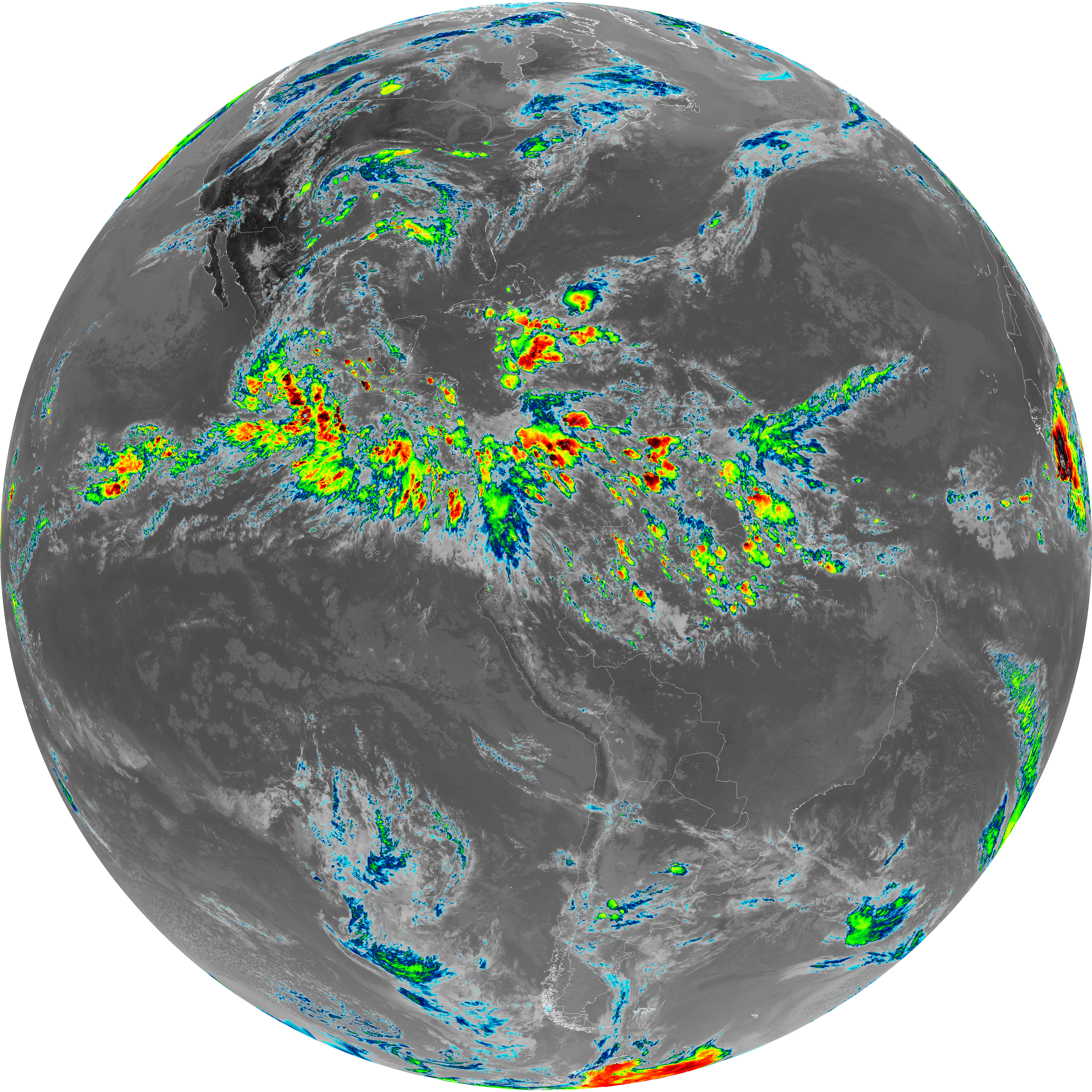
| G19_8_20260606T213021Z.png | 6075155 | 2026-Jun-06 21:52 |
| G19_9_20260606T213021Z.png | 7035552 | 2026-Jun-06 21:54 |
| abi_rgb_Upper-Level_Tropospheric_Water_Vapor.png | 8117368 | 2026-Jun-06 21:52 |
| abi_rgb_Upper-Level_Tropospheric_Water_Vapor_map.png | 8223198 | 2026-Jun-06 21:52 |
| abi_rgb_Mid-level_Tropospheric_Water_Vapor.png | 9434339 | 2026-Jun-06 21:54 |
| abi_rgb_Mid-level_Tropospheric_Water_Vapor_map.png | 9529455 | 2026-Jun-06 21:54 |
| G19_2_20260606T213021Z.png | 10308561 | 2026-Jun-06 21:50 |
| G19_15_20260606T213021Z.png | 10620711 | 2026-Jun-06 22:00 |
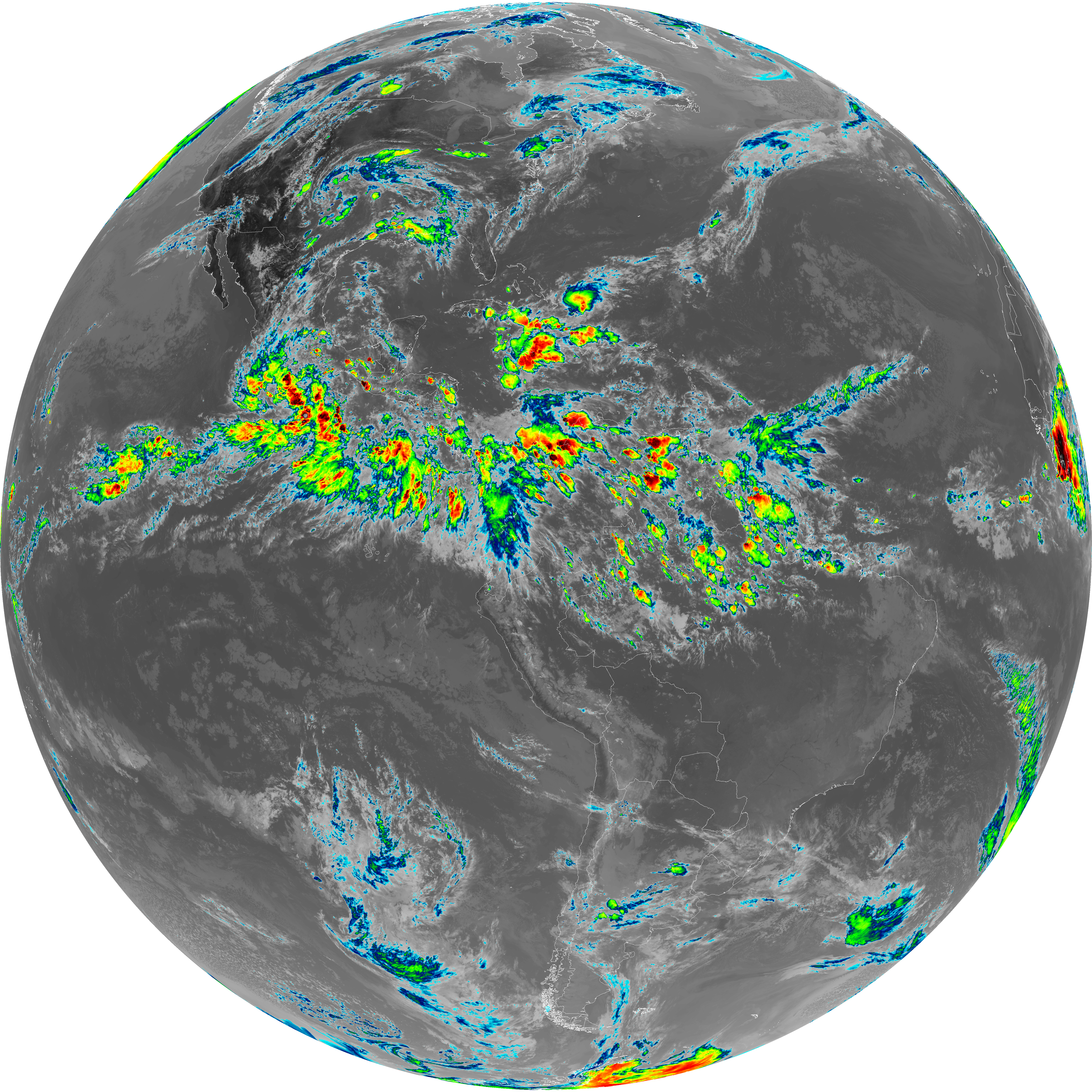
| G19_7_20260606T213021Z.png | 10646683 | 2026-Jun-06 21:43 |
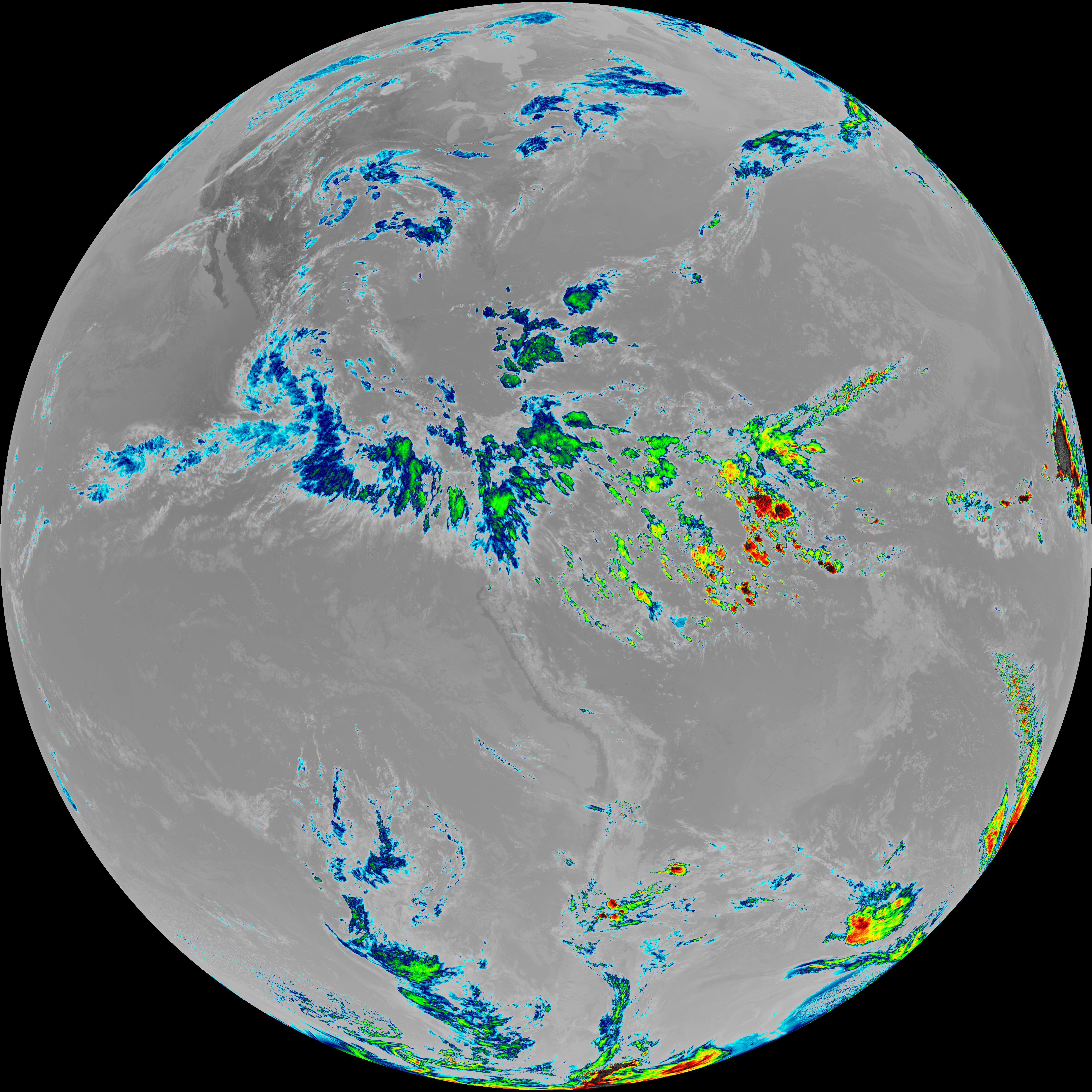
| G19_13_20260606T213021Z.png | 10736465 | 2026-Jun-06 21:46 |
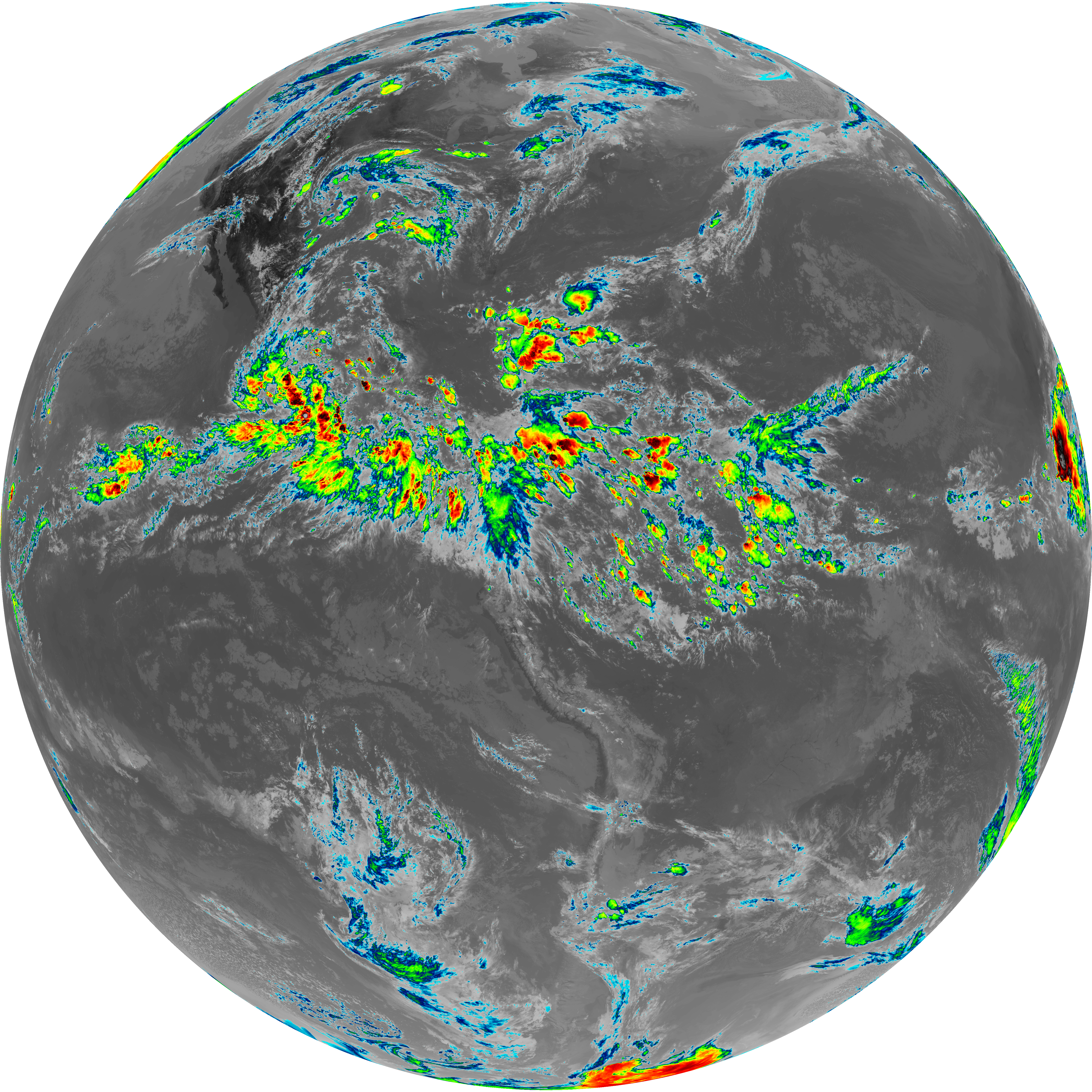
| G19_14_20260606T213021Z.png | 10886885 | 2026-Jun-06 21:57 |
| abi_rgb_Dirty_Longwave_Window_-_CIRA.png | 12676003 | 2026-Jun-06 22:01 |
| abi_rgb_Dirty_Longwave_Window_-_CIRA_map.png | 12726232 | 2026-Jun-06 22:01 |
| abi_rgb_Dirty_Longwave_Window.png | 14296251 | 2026-Jun-06 22:00 |
| abi_rgb_Dirty_Longwave_Window_map.png | 14333603 | 2026-Jun-06 22:00 |
| abi_rgb_Clean_Longwave_IR_Window_Band.png | 14434635 | 2026-Jun-06 21:46 |
| abi_rgb_Clean_Longwave_IR_Window_Band_map.png | 14469605 | 2026-Jun-06 21:46 |
| abi_rgb_Shortwave_Window_Band.png | 14536560 | 2026-Jun-06 21:43 |
| abi_rgb_Shortwave_Window_Band_map.png | 14587640 | 2026-Jun-06 21:43 |
| abi_rgb_Infrared_Longwave_Window_Band.png | 14611274 | 2026-Jun-06 21:57 |
| abi_rgb_Infrared_Longwave_Window_Band_map.png | 14645111 | 2026-Jun-06 21:57 |