| Parent directory/ | - | - |
| abi_rgb_Shortwave_Window_Band_map.png | 15540291 | 2026-Jun-07 03:14 |
| abi_rgb_Shortwave_Window_Band.png | 15485945 | 2026-Jun-07 03:14 |
| abi_rgb_Infrared_Longwave_Window_Band_map.png | 14158388 | 2026-Jun-07 03:24 |
| abi_rgb_Infrared_Longwave_Window_Band.png | 14113374 | 2026-Jun-07 03:24 |
| abi_rgb_Clean_Longwave_IR_Window_Band_map.png | 13986463 | 2026-Jun-07 03:17 |
| abi_rgb_Clean_Longwave_IR_Window_Band.png | 13940997 | 2026-Jun-07 03:17 |
| abi_rgb_Dirty_Longwave_Window_map.png | 13853323 | 2026-Jun-07 03:27 |
| abi_rgb_Dirty_Longwave_Window.png | 13805085 | 2026-Jun-07 03:27 |
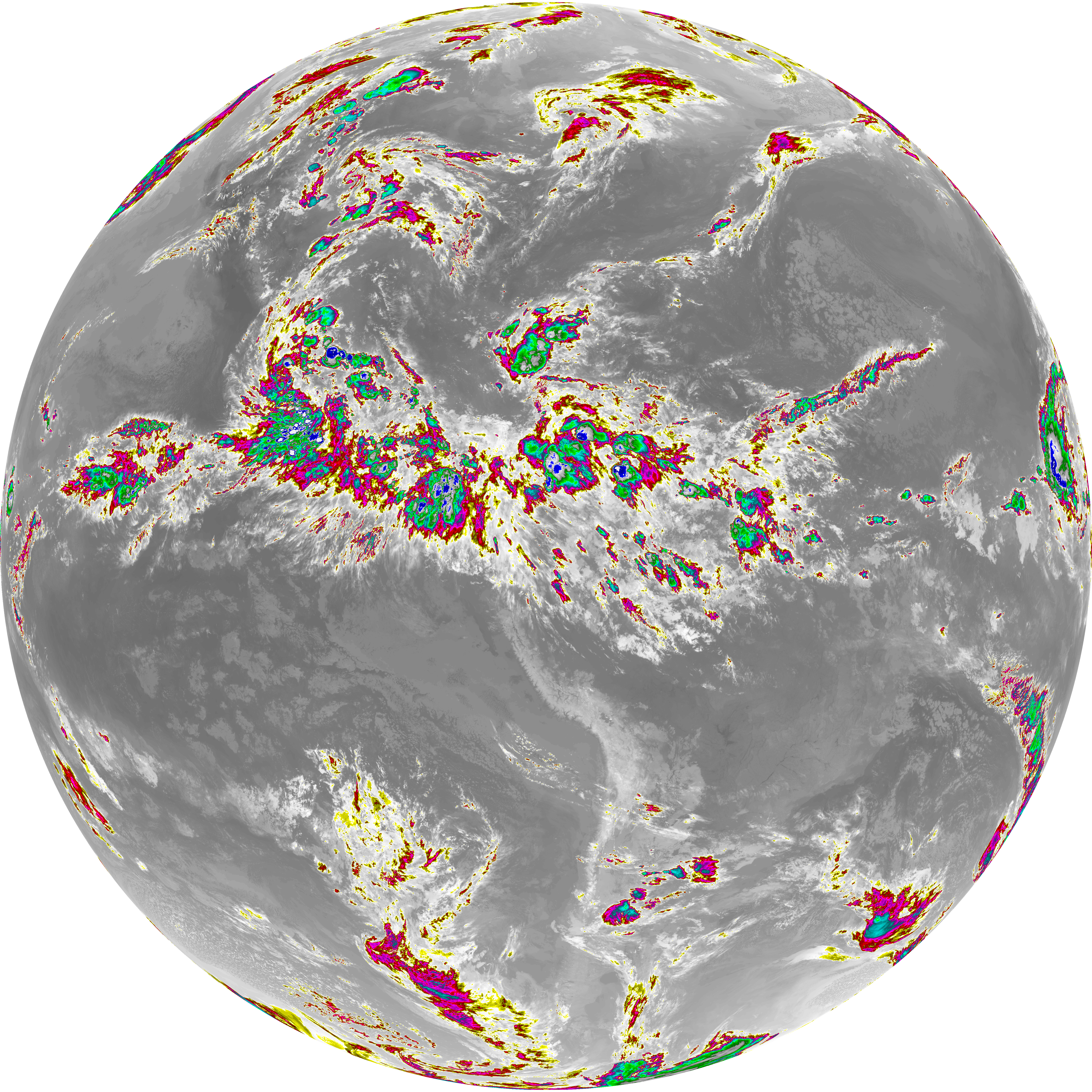
| abi_rgb_Dirty_Longwave_Window_-_CIRA_map.png | 12219719 | 2026-Jun-07 03:27 |
| abi_rgb_Dirty_Longwave_Window_-_CIRA.png | 12159200 | 2026-Jun-07 03:27 |
| G19_7_20260607T030021Z.png | 11282539 | 2026-Jun-07 03:13 |
| G19_14_20260607T030021Z.png | 10519351 | 2026-Jun-07 03:24 |
| G19_13_20260607T030021Z.png | 10368009 | 2026-Jun-07 03:16 |
| G19_15_20260607T030021Z.png | 10261203 | 2026-Jun-07 03:27 |
| abi_rgb_Mid-level_Tropospheric_Water_Vapor_map.png | 8998018 | 2026-Jun-07 03:21 |
| abi_rgb_Mid-level_Tropospheric_Water_Vapor.png | 8899200 | 2026-Jun-07 03:21 |
| abi_rgb_Upper-Level_Tropospheric_Water_Vapor_map.png | 7735188 | 2026-Jun-07 03:19 |
| abi_rgb_Upper-Level_Tropospheric_Water_Vapor.png | 7625085 | 2026-Jun-07 03:19 |
| G19_9_20260607T030021Z.png | 6640087 | 2026-Jun-07 03:21 |
| G19_8_20260607T030021Z.png | 5702412 | 2026-Jun-07 03:19 |
| G19_2_20260607T030021Z.png | 1210128 | 2026-Jun-07 03:17 |