| Parent directory/ | - | - |
| G19_13_20260608T070021Z.png | 10186578 | 2026-Jun-08 07:16 |
| G19_14_20260608T070021Z.png | 10325697 | 2026-Jun-08 07:23 |
| G19_15_20260608T070021Z.png | 10049624 | 2026-Jun-08 07:26 |
| G19_2_20260608T070021Z.png | 1355669 | 2026-Jun-08 07:16 |
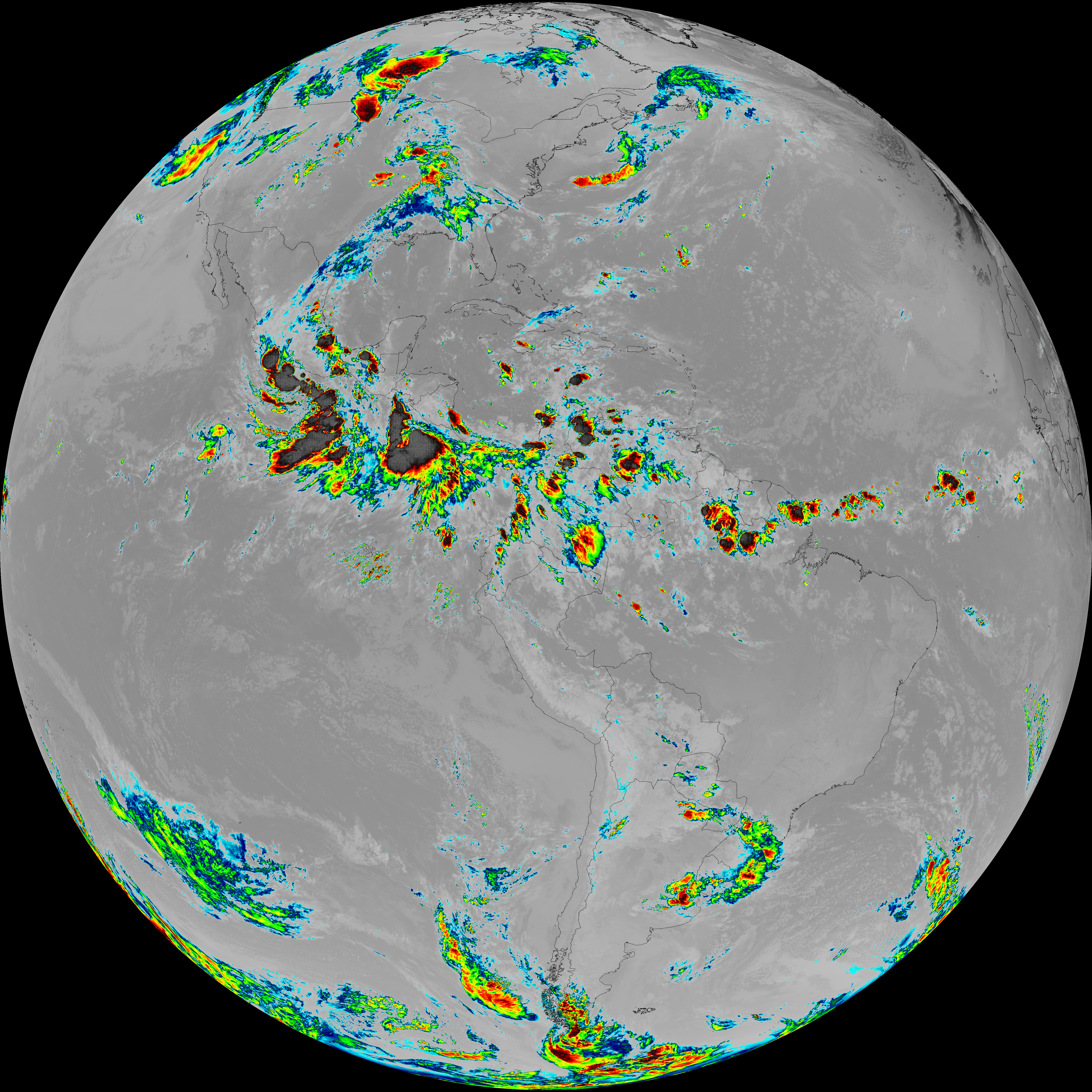
| G19_7_20260608T070021Z.png | 11238387 | 2026-Jun-08 07:13 |
| G19_8_20260608T070021Z.png | 5462088 | 2026-Jun-08 07:18 |
| G19_9_20260608T070021Z.png | 6322500 | 2026-Jun-08 07:20 |
| abi_rgb_Clean_Longwave_IR_Window_Band.png | 13688724 | 2026-Jun-08 07:16 |
| abi_rgb_Clean_Longwave_IR_Window_Band_map.png | 13733421 | 2026-Jun-08 07:16 |
| abi_rgb_Dirty_Longwave_Window.png | 13513046 | 2026-Jun-08 07:26 |
| abi_rgb_Dirty_Longwave_Window_-_CIRA.png | 11805830 | 2026-Jun-08 07:27 |
| abi_rgb_Dirty_Longwave_Window_-_CIRA_map.png | 11867725 | 2026-Jun-08 07:27 |
| abi_rgb_Dirty_Longwave_Window_map.png | 13561738 | 2026-Jun-08 07:26 |
| abi_rgb_Infrared_Longwave_Window_Band.png | 13842505 | 2026-Jun-08 07:24 |
| abi_rgb_Infrared_Longwave_Window_Band_map.png | 13886643 | 2026-Jun-08 07:24 |
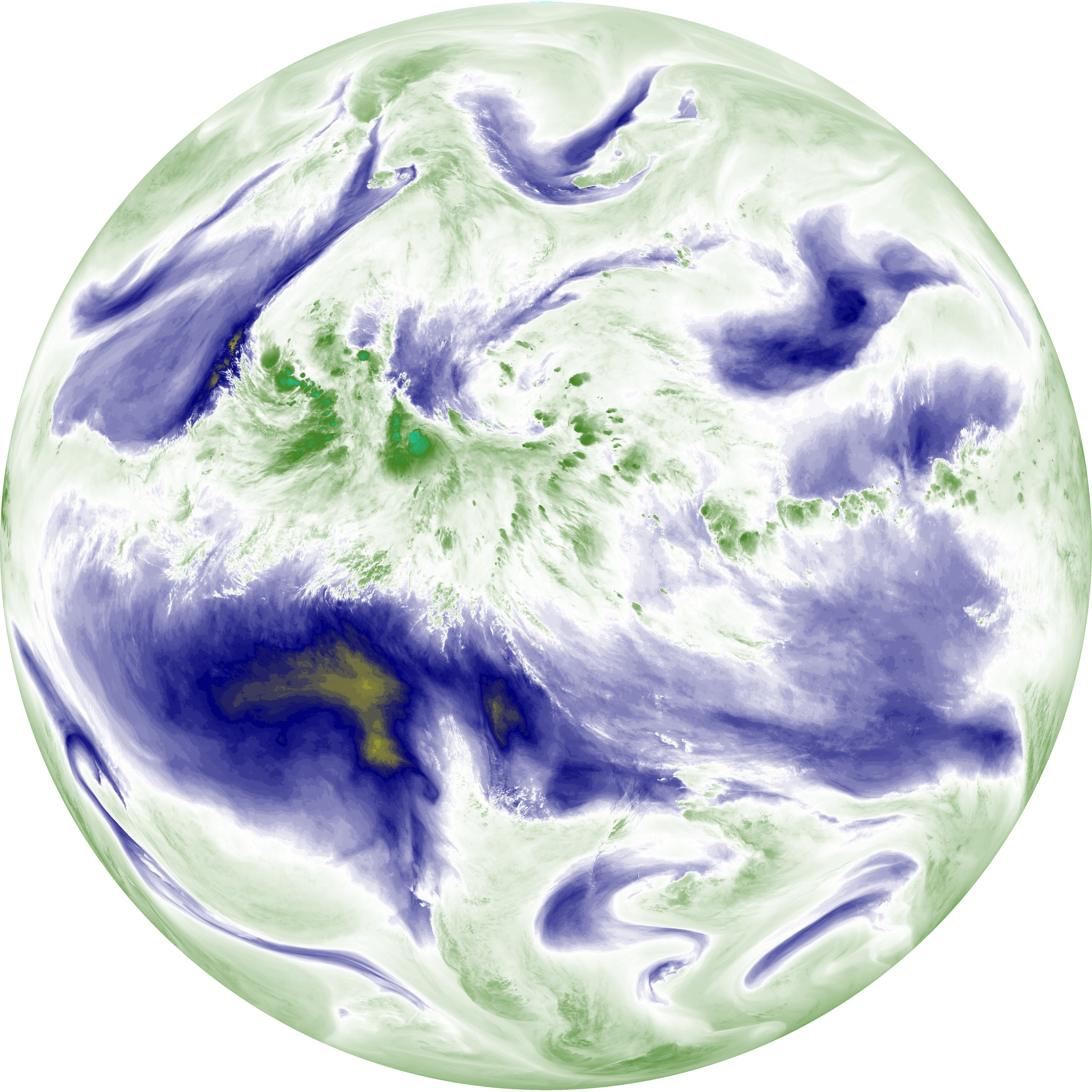
| abi_rgb_Mid-level_Tropospheric_Water_Vapor.png | 8530573 | 2026-Jun-08 07:20 |
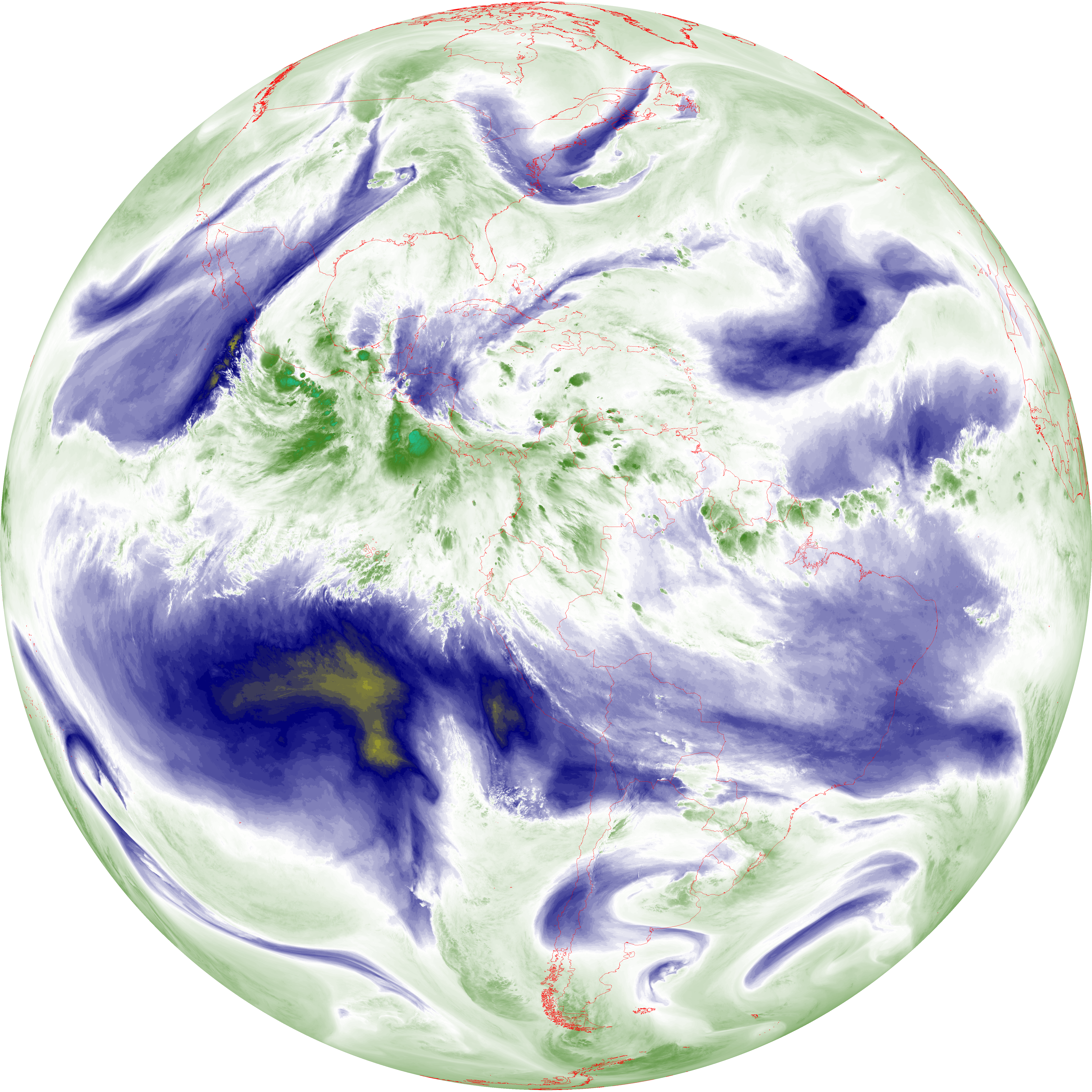
| abi_rgb_Mid-level_Tropospheric_Water_Vapor_map.png | 8634036 | 2026-Jun-08 07:20 |
| abi_rgb_Shortwave_Window_Band.png | 15393004 | 2026-Jun-08 07:13 |
| abi_rgb_Shortwave_Window_Band_map.png | 15442702 | 2026-Jun-08 07:13 |
| abi_rgb_Upper-Level_Tropospheric_Water_Vapor.png | 7317932 | 2026-Jun-08 07:18 |
| abi_rgb_Upper-Level_Tropospheric_Water_Vapor_map.png | 7431014 | 2026-Jun-08 07:19 |