| Parent directory/ | - | - |
| abi_rgb_Upper-Level_Tropospheric_Water_Vapor_map.png | 7463174 | 2026-Jun-08 13:52 |
| abi_rgb_Upper-Level_Tropospheric_Water_Vapor.png | 7349491 | 2026-Jun-08 13:52 |
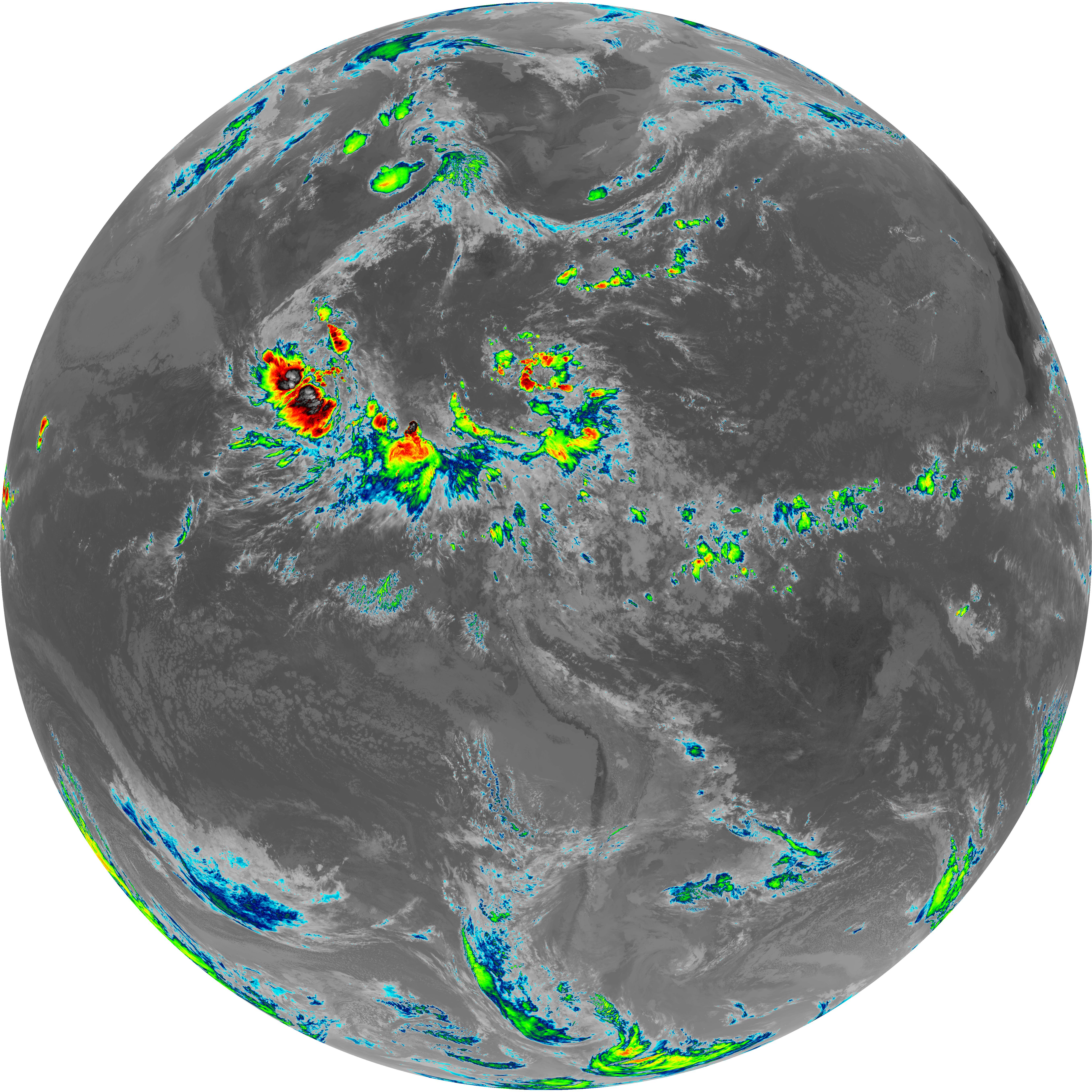
| abi_rgb_Shortwave_Window_Band_map.png | 14291908 | 2026-Jun-08 13:43 |
| abi_rgb_Shortwave_Window_Band.png | 14233978 | 2026-Jun-08 13:43 |
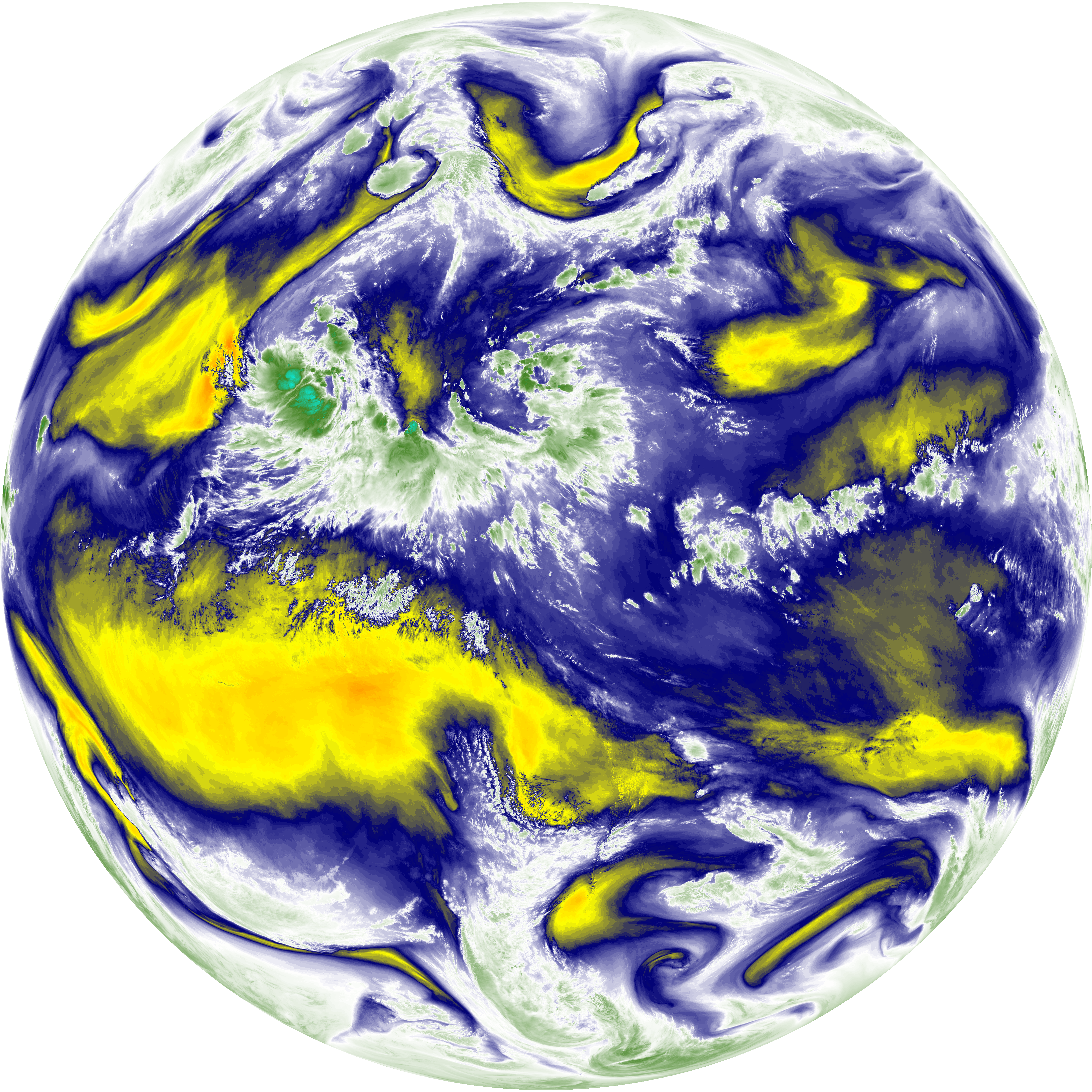
| abi_rgb_Mid-level_Tropospheric_Water_Vapor_map.png | 8630732 | 2026-Jun-08 13:54 |
| abi_rgb_Mid-level_Tropospheric_Water_Vapor.png | 8524773 | 2026-Jun-08 13:54 |
| abi_rgb_Infrared_Longwave_Window_Band_map.png | 13976437 | 2026-Jun-08 13:57 |
| abi_rgb_Infrared_Longwave_Window_Band.png | 13939610 | 2026-Jun-08 13:57 |
| abi_rgb_Dirty_Longwave_Window_map.png | 13639405 | 2026-Jun-08 14:00 |
| abi_rgb_Dirty_Longwave_Window_-_CIRA_map.png | 12035016 | 2026-Jun-08 14:00 |
| abi_rgb_Dirty_Longwave_Window_-_CIRA.png | 11979827 | 2026-Jun-08 14:00 |
| abi_rgb_Dirty_Longwave_Window.png | 13598856 | 2026-Jun-08 13:59 |
| abi_rgb_Clean_Longwave_IR_Window_Band_map.png | 13831943 | 2026-Jun-08 13:46 |
| abi_rgb_Clean_Longwave_IR_Window_Band.png | 13794993 | 2026-Jun-08 13:46 |
| G19_9_20260608T133021Z.png | 6307928 | 2026-Jun-08 13:54 |
| G19_8_20260608T133021Z.png | 5489371 | 2026-Jun-08 13:52 |
| G19_7_20260608T133021Z.png | 10359772 | 2026-Jun-08 13:43 |
| G19_2_20260608T133021Z.png | 12980019 | 2026-Jun-08 13:50 |
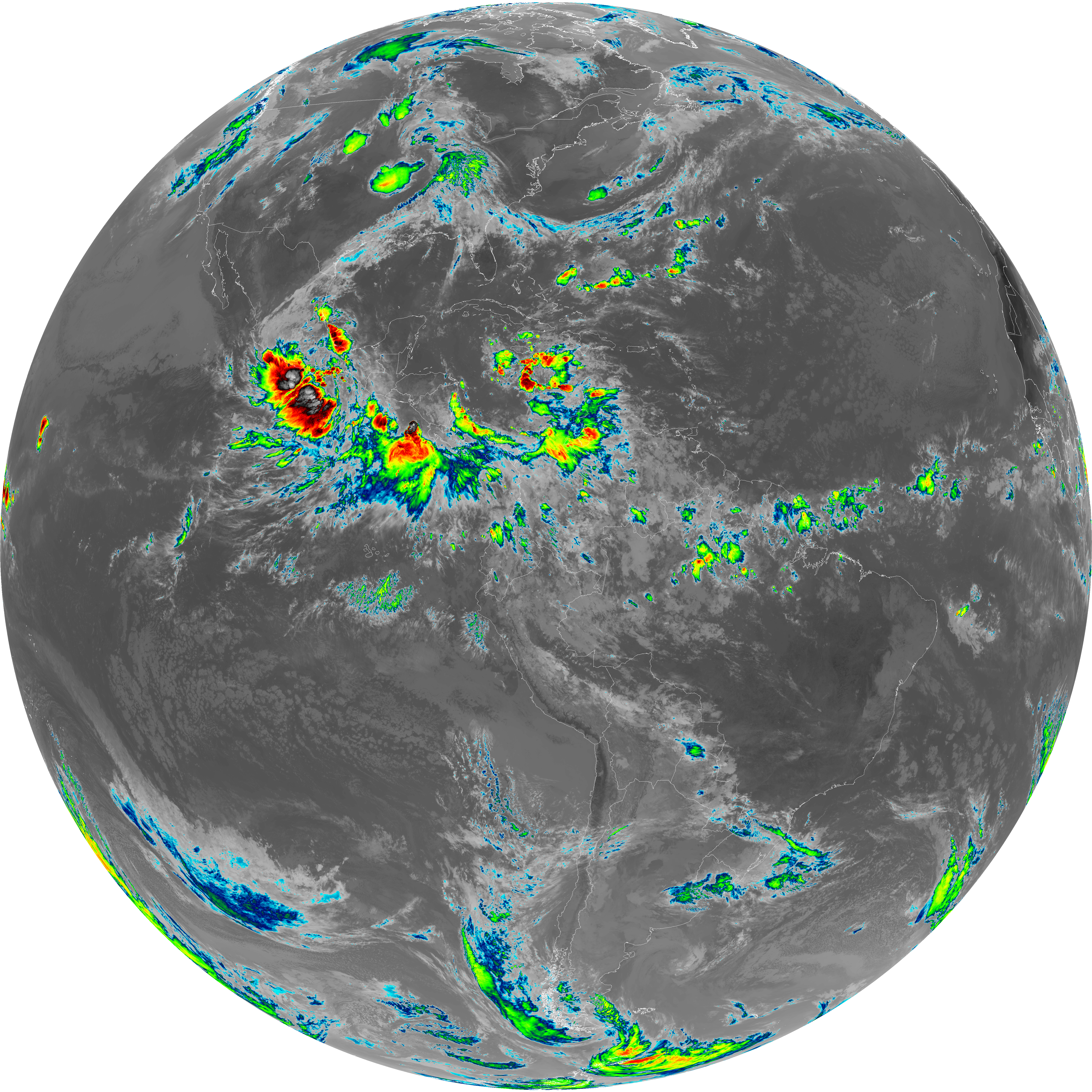
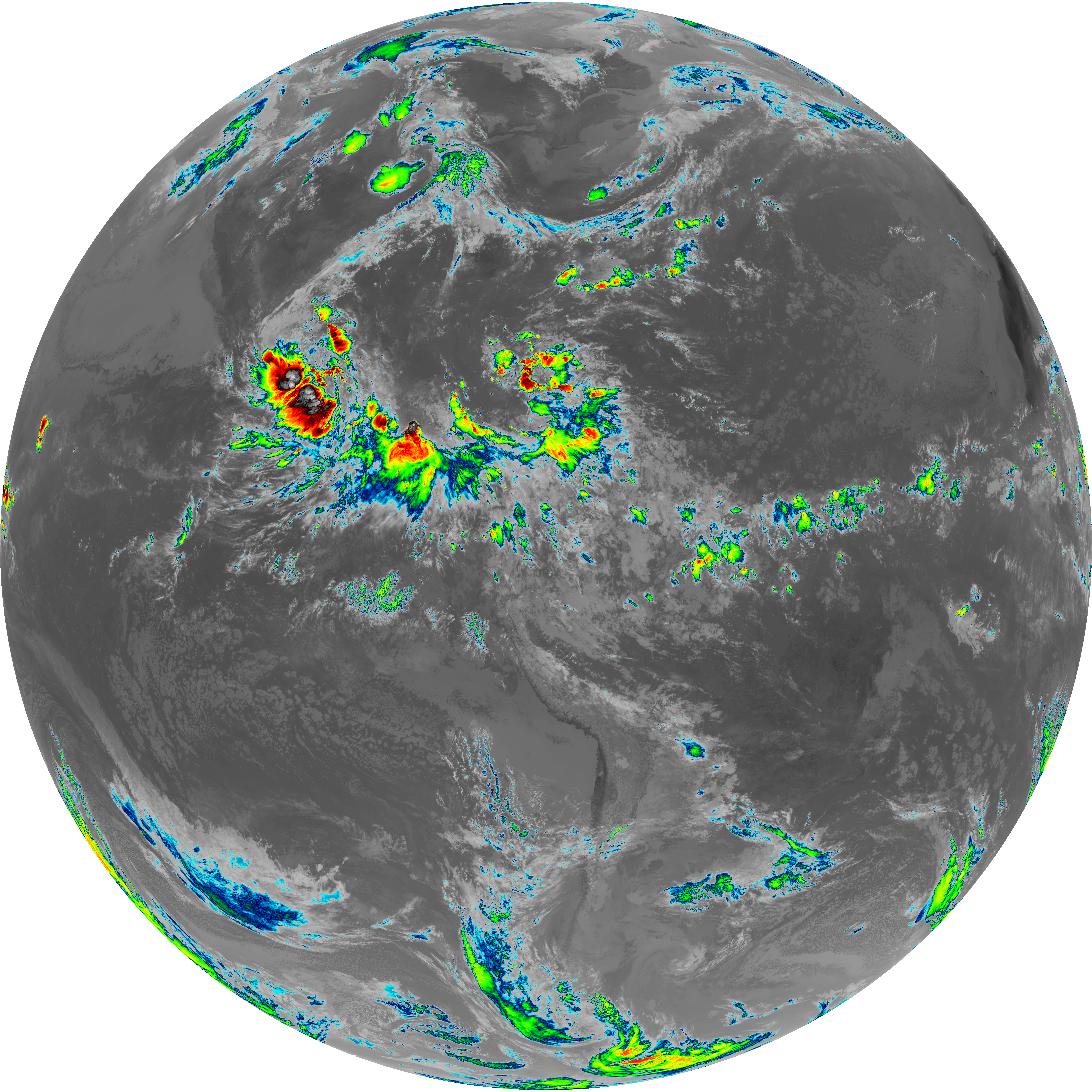
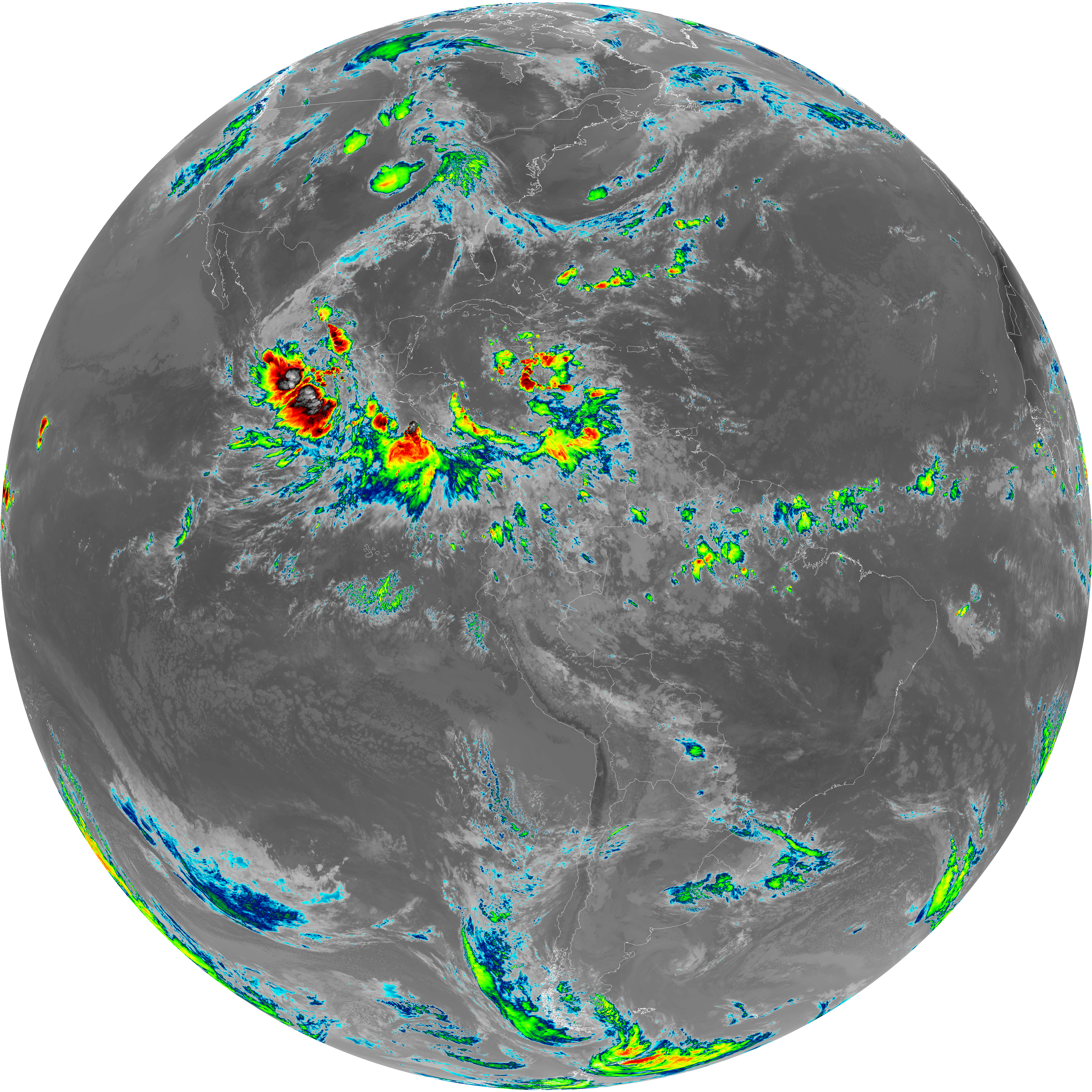
| G19_15_20260608T133021Z.png | 10101135 | 2026-Jun-08 13:59 |
| G19_14_20260608T133021Z.png | 10401273 | 2026-Jun-08 13:57 |
| G19_13_20260608T133021Z.png | 10279899 | 2026-Jun-08 13:46 |