Quicklook renderings of ABI Level-2 geophysical fields. Each timestamp mirrors an imagery folder and includes a product.cbor metadata file.
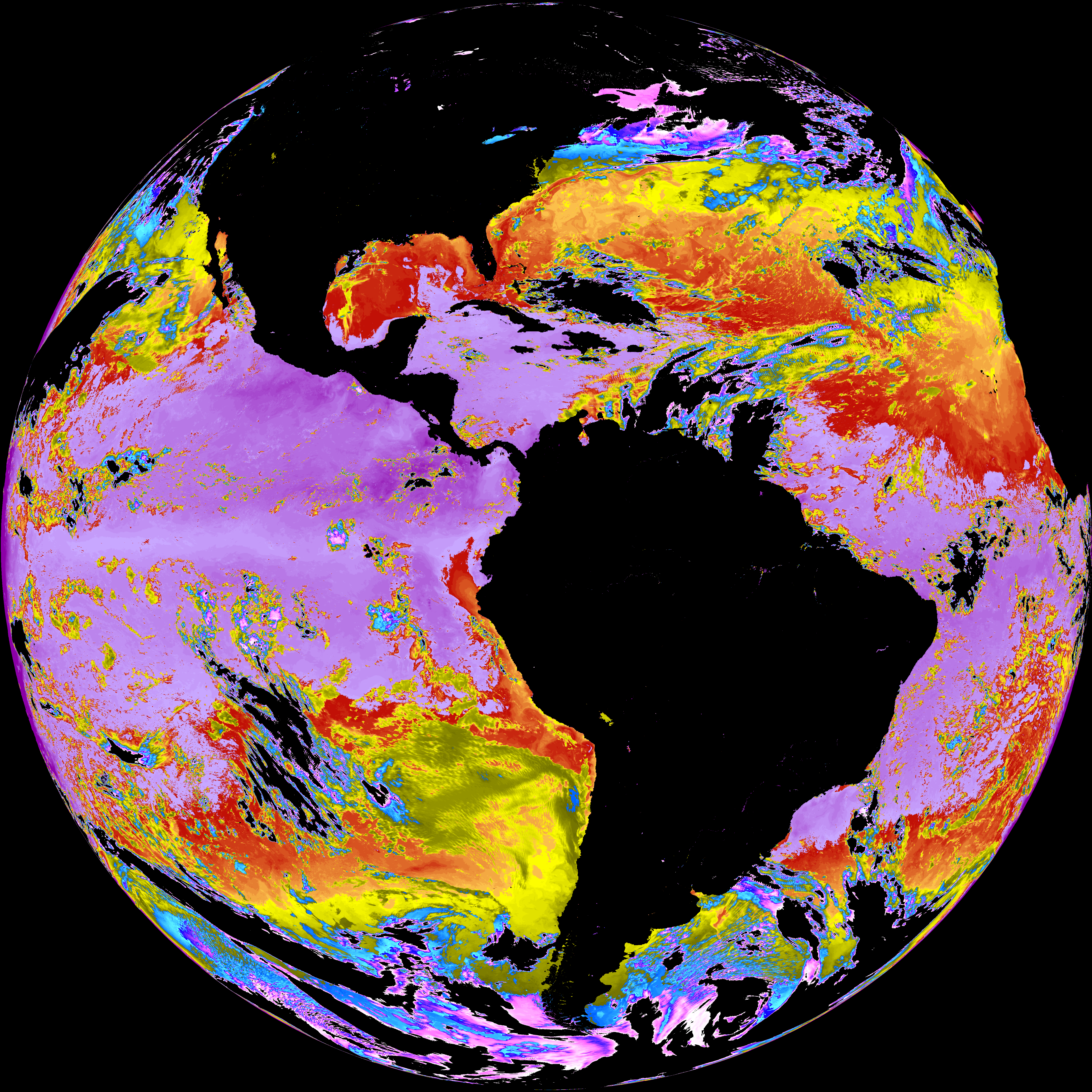
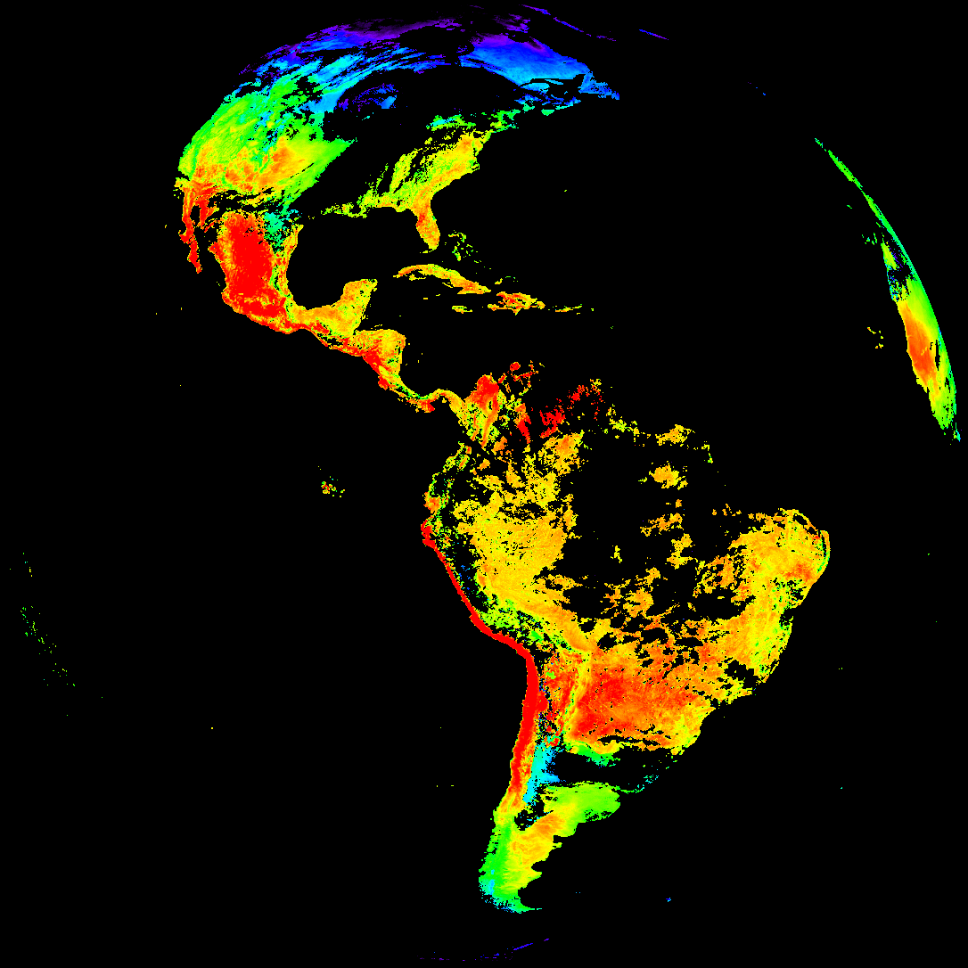
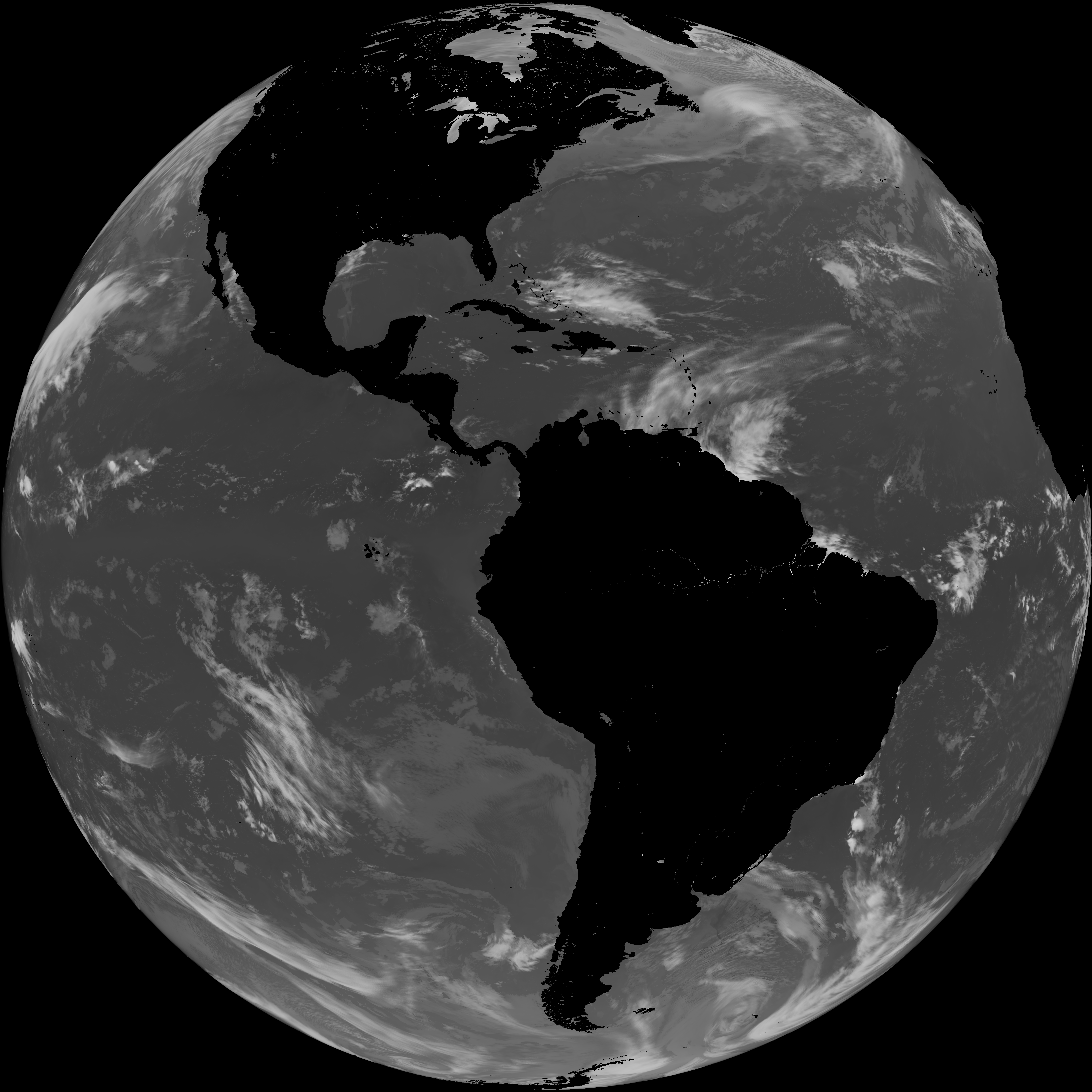
ACHT/ACHA), Derived Stability Indices (DSI), Total Precipitable Water (TPW), Rain Rate/QPE (RRQPE).SST/LST).G19_TPW_YYYYMMDDThhmmssZ.png with matching abi_rgb_* composites.The accompanying product.cbor files contain projection details that map pixels to Earth coordinates and physical units.
| File Name ↓ | File Size ↓ | Date ↓ |
|---|---|---|
| Parent directory/ | - | - |
| product.cbor | 554 | 2026-Apr-04 19:12 |
| abi_rgb_Sea_Surface_Temperature_map.png | 7588599 | 2026-Apr-04 19:10 |
| abi_rgb_Sea_Surface_Temperature.png | 7489963 | 2026-Apr-04 19:10 |
| abi_rgb_Land_Surface_Temperature_map.png | 178242 | 2026-Apr-04 19:12 |
| abi_rgb_Land_Surface_Temperature.png | 172206 | 2026-Apr-04 19:12 |
| abi_rgb_Cloud_top_Temperature_(ACHT)_map.png | 10342589 | 2026-Apr-04 19:06 |
| abi_rgb_Cloud_top_Temperature_(ACHT).png | 10219856 | 2026-Apr-04 19:06 |
| G19_SST_20260404T180020Z.png | 7391494 | 2026-Apr-04 19:10 |
| G19_LST_20260404T180020Z.png | 133610 | 2026-Apr-04 19:12 |
| G19_ACHT_20260404T180020Z.png | 7485682 | 2026-Apr-04 19:06 |